Maps & Animations
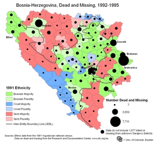
Map showing dead and missing in Bosnia-Herzegovina from 1992-1995.
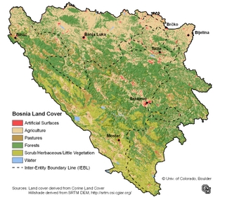
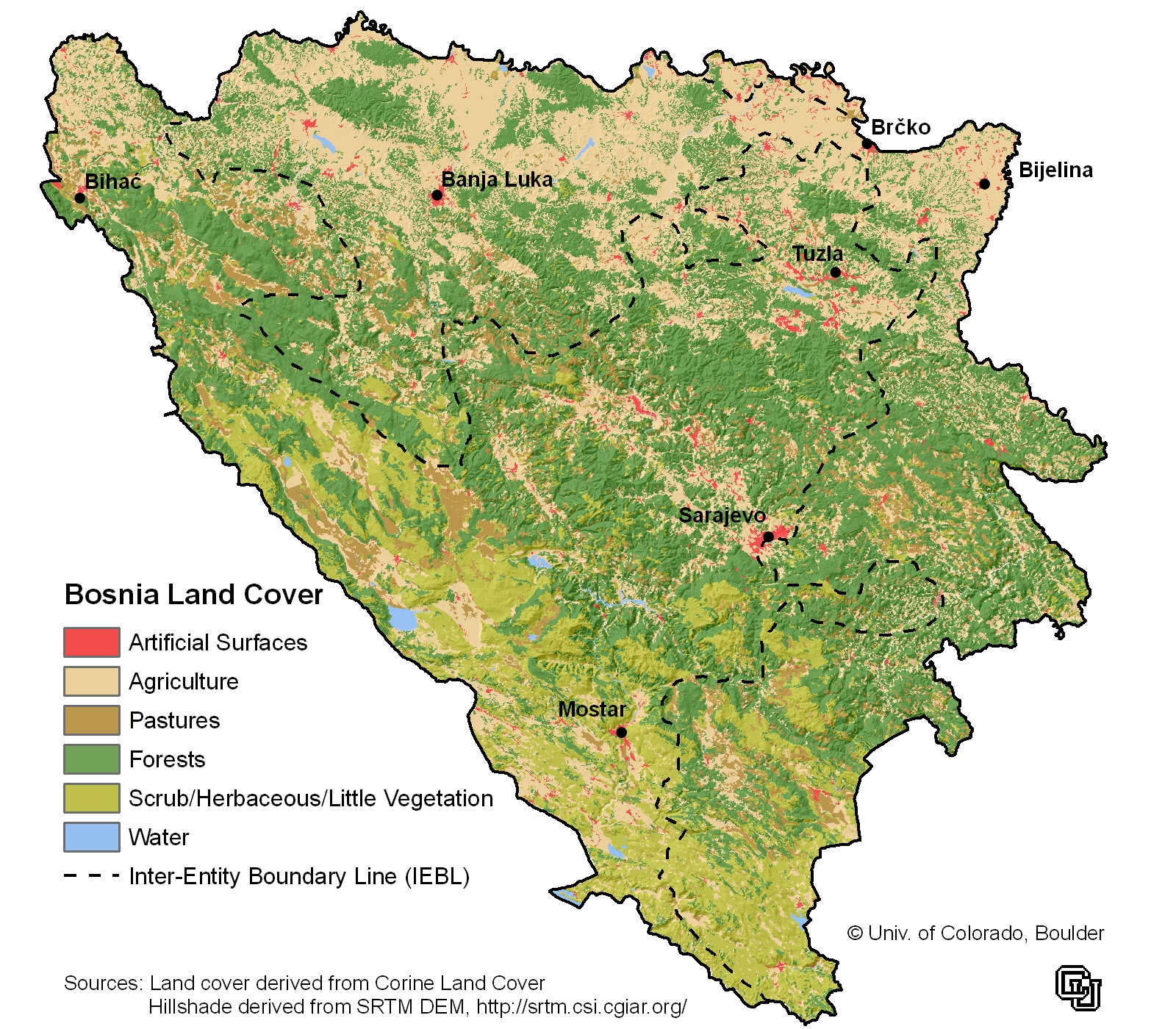
Pre-war land cover for Bosnia-Herzegovina from the European Environment Agency. Land cover data overlaid onto a hillshade generated from digital elevation model collected by the Space Shuttle Endeavor.
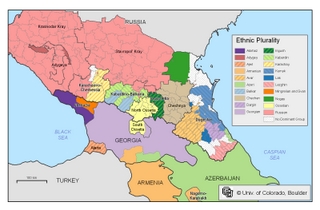
Ethnic pluralities map of the Caucasus compiled from Beroutchachvili and Radvanyi (1996), 2002 Russian Census, Goskomstat Rossii (2004), and Rowland (2004, 2006, 2007).
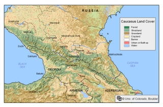
Land Cover map of the Caucasus with a hillshade to show elevation. Data from Univ. of Maryland's Global Land Cover Facility (GLCF)(http://glcf.umiacs.umd.edu/data/landcover/) and U.S. Geological Survey (http://glcf.umiacs.umd.edu/data/srtm/)
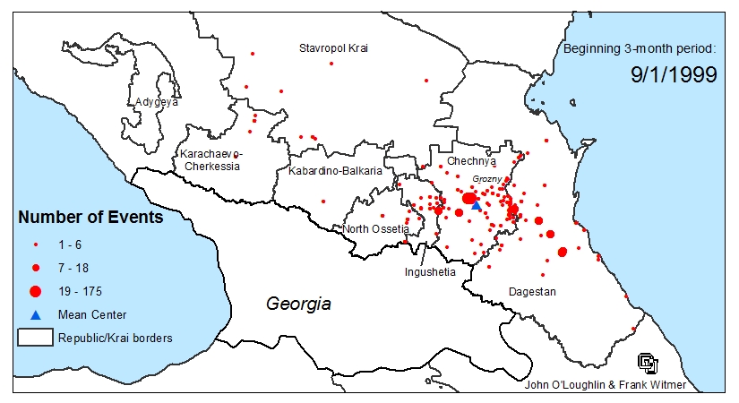
Animation of violent events by season, Sep 1999 - Aug 2007 (20 MB file). Created by John O'Loughlin and Frank Witmer